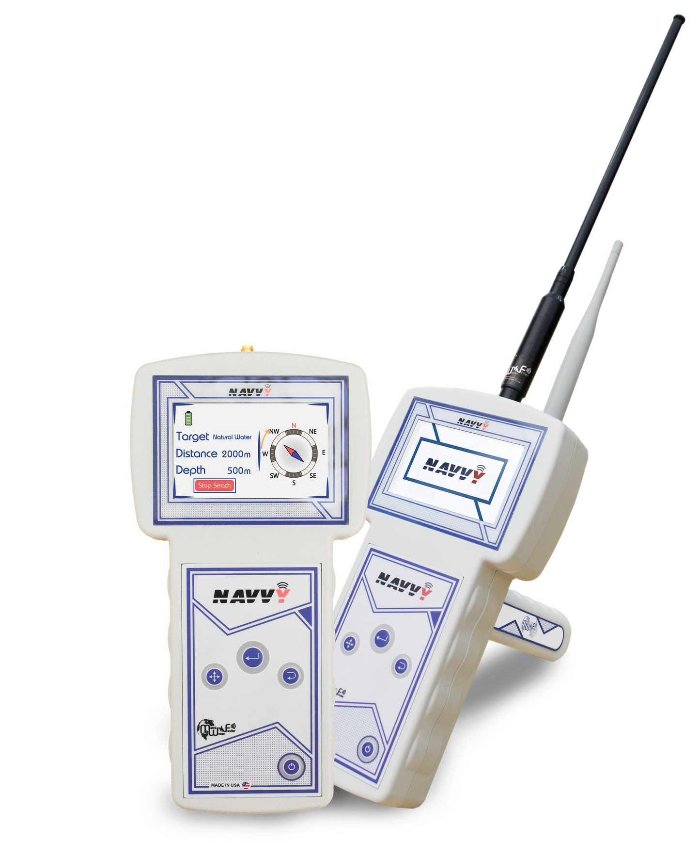
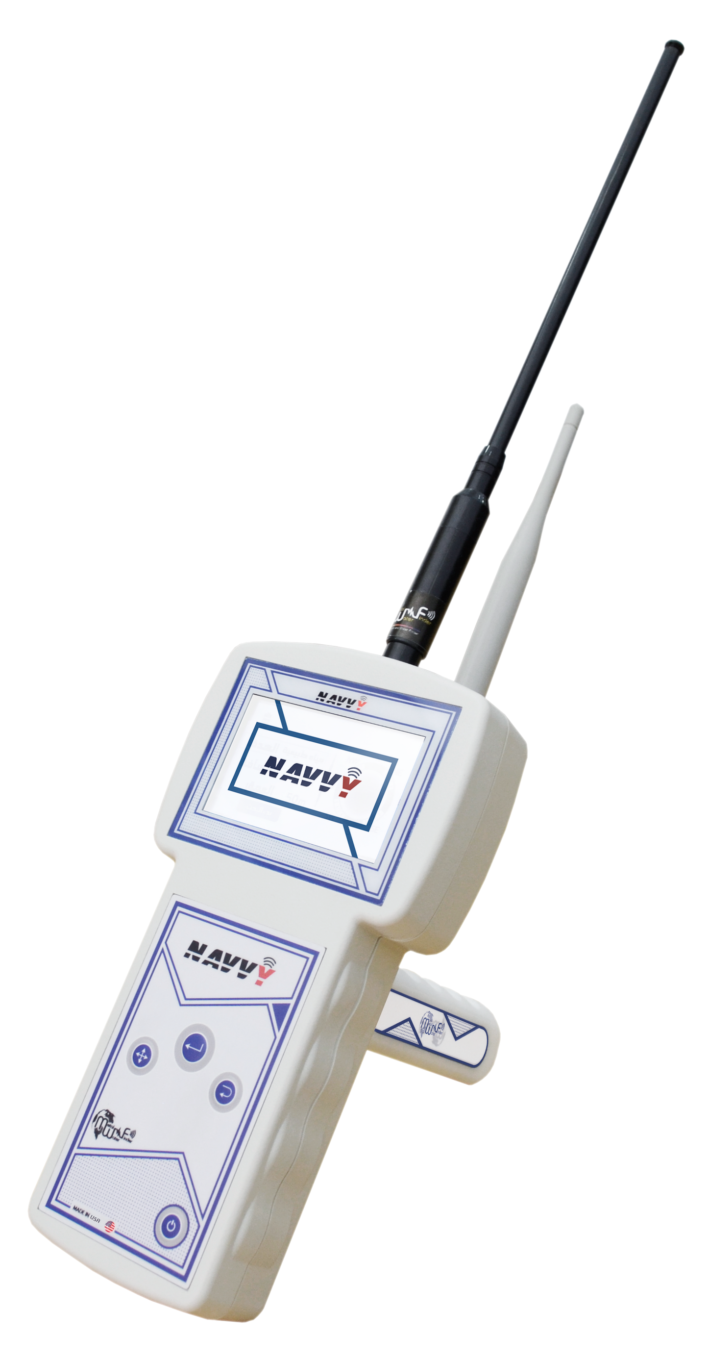
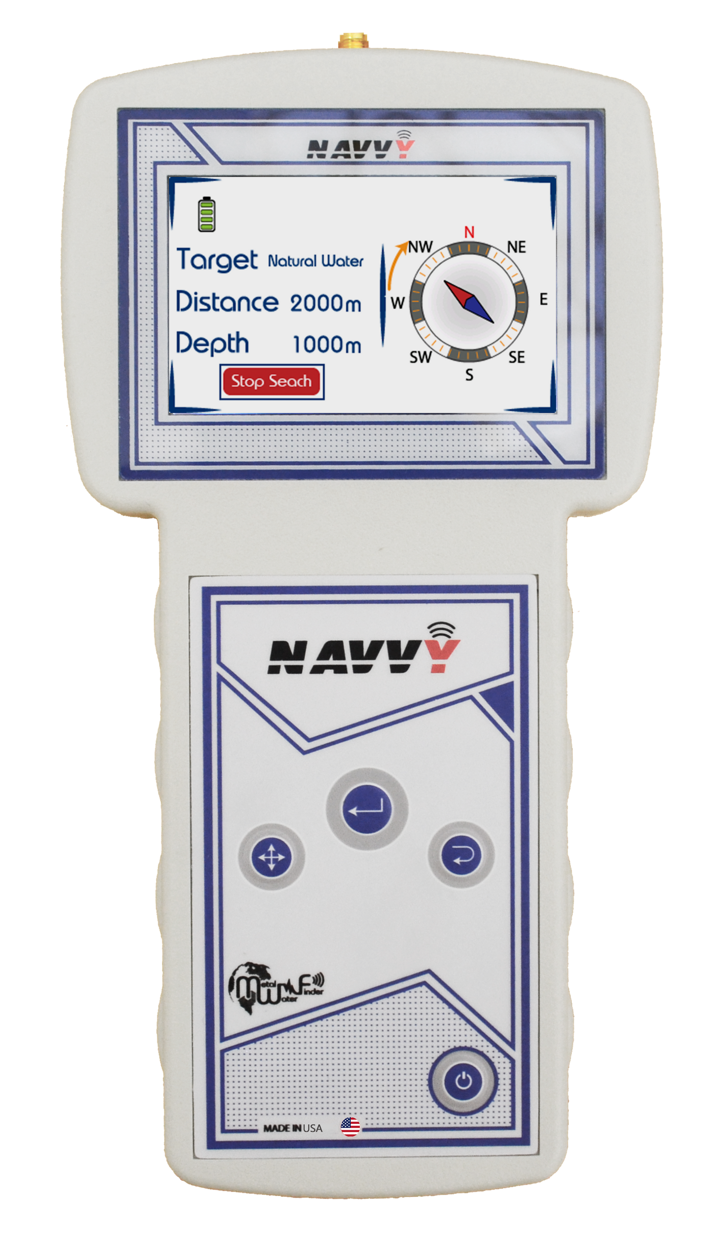
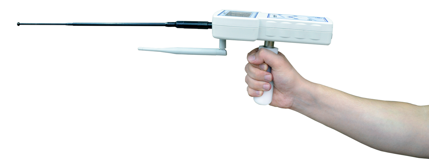
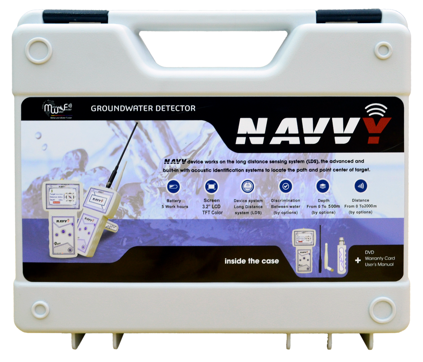
The Navvy is an ultra-portable groundwater detector designed to get you on target fast. It couples long-range sensing with a digital compass and clear acoustic cues so you can set direction and walk-in quickly, then validate and refine the point center. Compact hardware, a crisp 3.2" TFT screen, and simplified controls make it an easy fit for one-person operations and rapid surveys.
How It Works & Key Features
Navvy’s ATS auto tuning evaluates the surrounding soil and automatically applies the right signal profile to cut through mineral noise. A streamlined interface provides quick access to depth and distance presets along with water type filters (natural, mineral, salty, all). Practical touches—multilingual UI, adjustable brightness, vibration/silent modes, and smart battery monitoring—keep you focused on the path rather than the settings. Internal filtering helps null common RF clutter so the on-screen direction and tone progression remain trustworthy.
Detection System
An advanced long-range locator with smart guidance graphics and laser assistance directs you toward the target. As you approach the signal lobe, audio intensifies and the compass overlay helps you hold the bearing.
Depth & Range
Depth: up to 500 m
Forward range: up to 2,000 m
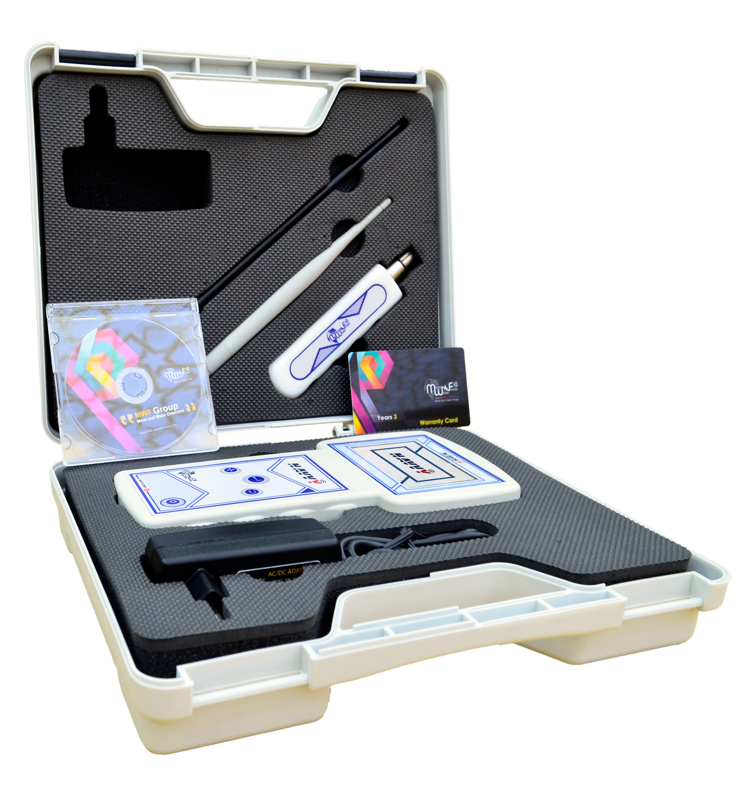
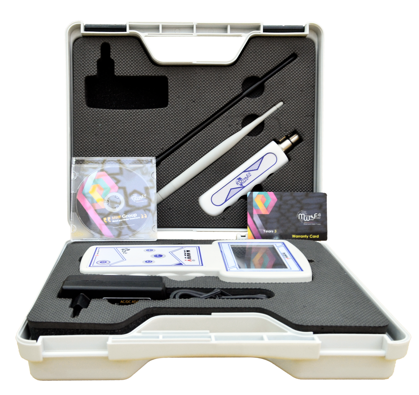
In the Box
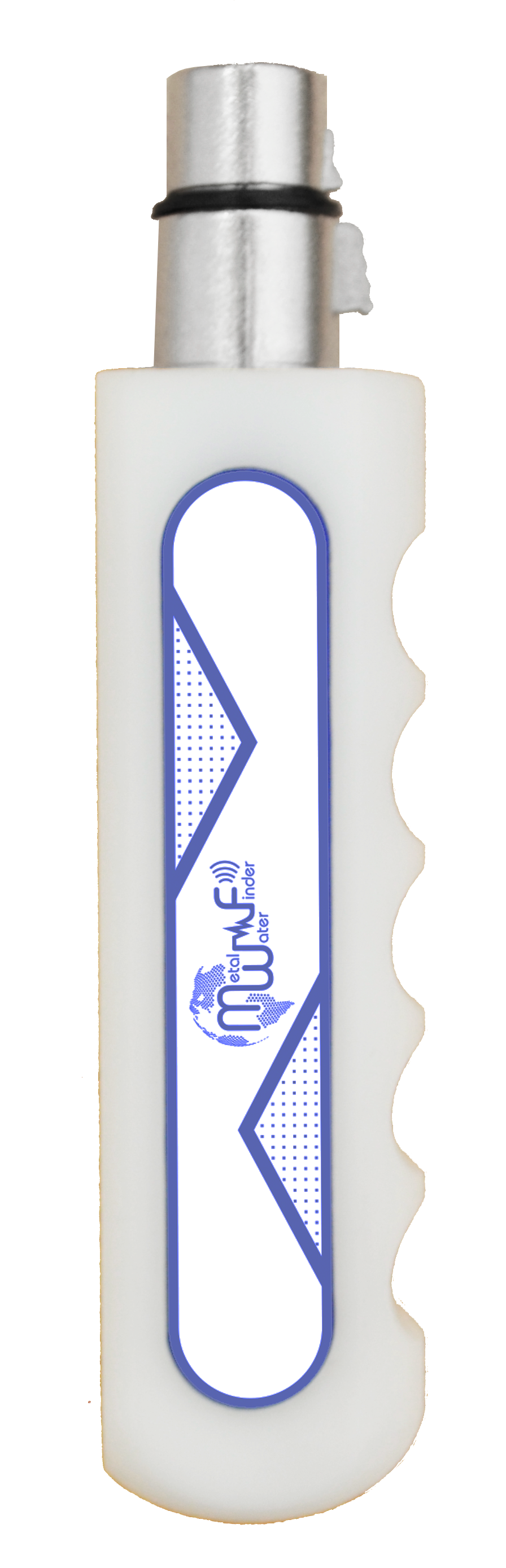
Main search/control unit, transceiver antenna, anti-shock case, charger, 3-year warranty card, user’s guide, tutorial DVD.
Warranty
3-Year Manufacturers Warranty
Why Choose This Model?
When portability and fast, directional certainty matter, Navvy offers a no-nonsense workflow that gets you from scanning to staking a drilling point with minimal setup.
Used it pre-survey for rural well placement. Depth ID read 86 meters, and drilling confirmed flow at 89m. Saved us a misfire and half a day's work.
P
Priya
Confirms depth consistently
I can confirm the Navvy's detection depth readings are on point. Used it in sedimentary rock valley and it tracked a water table across a 200-meter scan path.
L
Luis Mendoza
Real field value
It gave me confidence before spending $12K on drilling. Depth read 107m. Drilled to 110m and hit it. Worth every cent if you know how to work your terrain.
M
Maria Chen
Solid engineering, clean data
The build quality and signal calibration are impressive. This is not an amateur device. It takes practice to read well, but the data is reliable when cross-referenced against known maps.
C
Caleb Stone
Great for pre-drill validation
We’ve reduced dry bore risks significantly since adding this to our kit. Great for validation when GPR is unavailable or overkill.